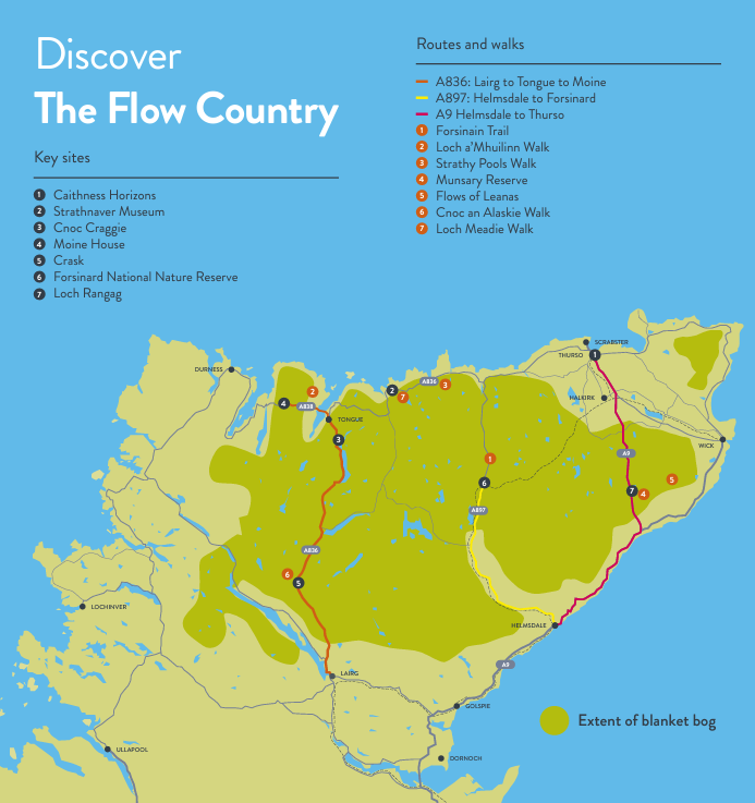
The Flows by Road
Drive along the winding strath roads which offer captivating views.
Scenic viewpoints and visitor attractions can be found along the A836 and A897.

Drive along the winding strath roads which offer captivating views.
Scenic viewpoints and visitor attractions can be found along the A836 and A897.
To visit the Flow Country from Lairg, head north on the single track A836. Heading away from Loch Shin the landscape to the east is dominated by Dalchork Forest, although large areas of the forest have been restored to peatland in recent years.
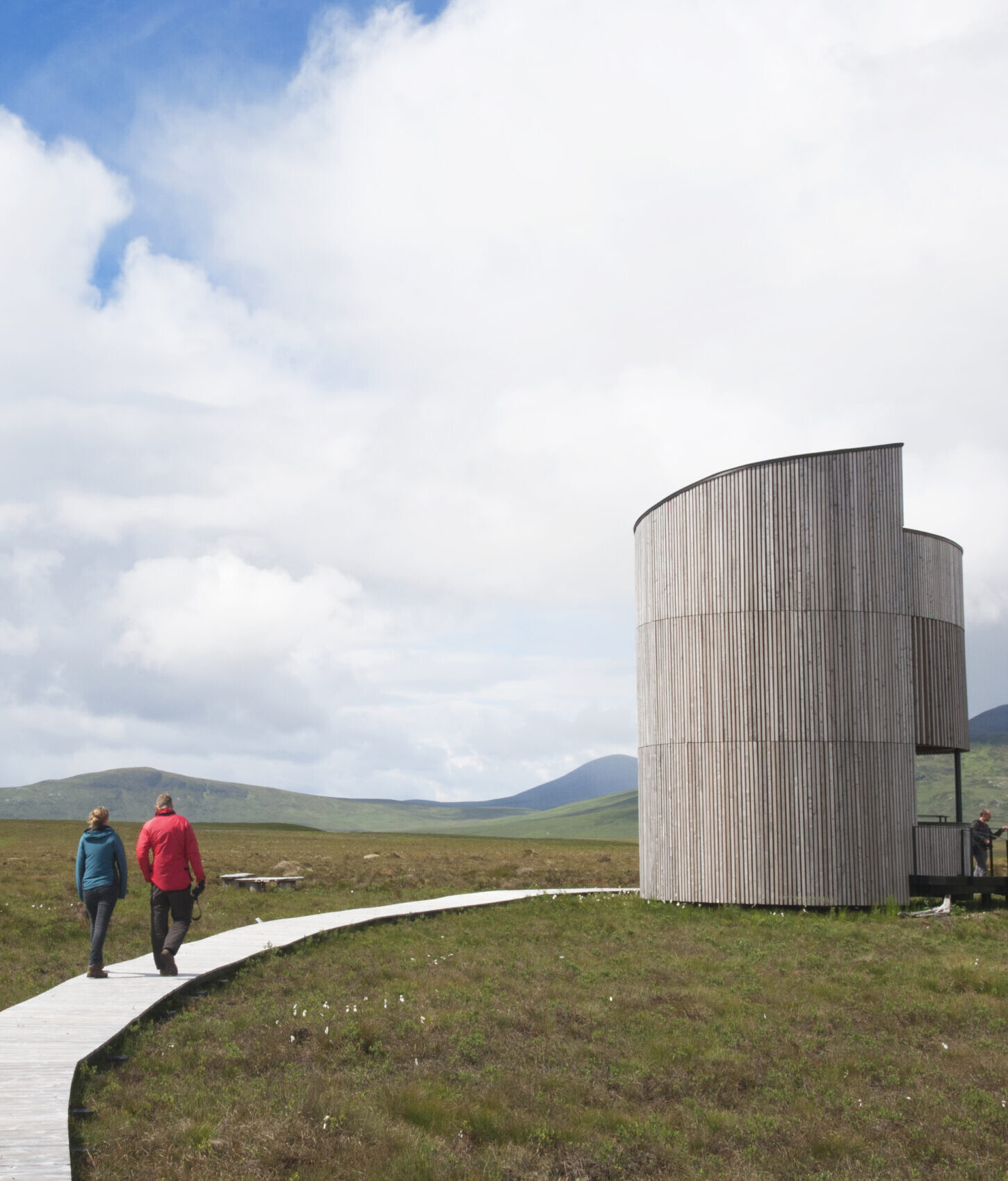
Just south of the Crask Inn is a viewpoint with information and seating. This is a great place to catch a glimpse of golden or white-tailed eagles or to listen out for greenshank and golden plover as they sing over the peatlands of Cnoc an Alaskie.
At the Crask Inn, the trees disappear to reveal distant views of Ben More Assynt (998m) and Ben Hee (873m) to the west and Ben Klibreck (931m) to the east. In the early morning in spring, it is also sometimes possible to see black grouse (Tetrao tetrix) displaying here.
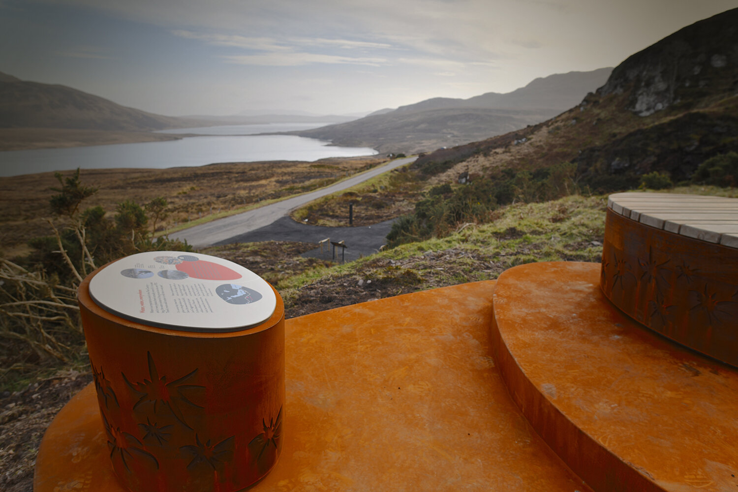
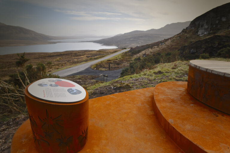
Continuing northwards the road follows the River Vafastie before entering Altnaharra. The road climbs gently to reveal Ben Loyal (764m) to the north and Ben Hope (927m) to the north-west. All around the peatland is broken up by rocky outcrops. At Loch Staing the road passes between two lochs, and then drops down and along the shore of Loch Loyal. The Cnoc Craggie viewpoint, at the top of Loch Loyal, offers stunning Flow Country panorama!
From the small fishing village of Helmsdale take the single track road towards Melvich and to the heart of the peatlands. You will pass Baile an Or – the site of Scotlands goldrush in 1869, where people still pan for gold today! The landscape opens up with wonderful views of Ben Armine (704m) and Ben Klibreck (961m) to the west and the Ben Griams to the north.
24 miles north of Helmsdale you will reach Forsinard and the RSPB Forsinard Flows National Nature Reserve.
When the A9 turns inland at Latheron follow the road for 5 miles. At Loch Rangag there is an information point and sweeping views to the South and West over peatlands, including Blar nam Faoileag, the bog of the seagulls. The impressive open landscape is framed to the north and south by windfarms.
There are two walks close to here listed on the Suggested Walks page.
Continue north for 18 miles and you will arrive at Thurso, the most northerly town on the UK mainland.